Home | Gauri Shankar and Menlungtse Main | Photo Index Page | Gauri Shankar and Menlungtse References | Contact 
Previous photo Next photo Thumbnail page
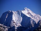
05 Menlungtse From Mountain Flight 2008 06 Menlungtse From Mountain Flight 1997 10 17 Peak 41, Hongu Peak, Peak 43 Kyashar, Malanphulan, Kangtega, Ombigaichen, Ama Dablam, Gauri Shankar, Menlungtse, Taweche From West Col 10 20 Gauri Shankar, Drangnag Ri, Menlungtse, Taweche From West Col 09 Menlungtse Close Up Morning And Noon From Trek Between Shingdip And Shishapangma Southwest Advanced Base Camp
First page Previous page Index page Next page Last page
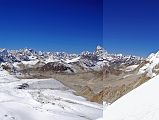
10 17 Peak 41, Hongu Peak, Peak 43 Kyashar, Malanphulan, Kangtega, Ombigaichen, Ama Dablam, Gauri Shankar, Menlungtse, Taweche From West Col  [7 of 15]


From the top of the West Col (6135m), the view from southwest to north included P6770, Peak 41, Hongu Peak, Peak 43 Kyashar, Malanphulan, Kangtega, Khatang and Numbur, Tengkangpoche, Panalotapa, Bigphera Go Shar, Mingbo La, Tengi Ragi Tau, Ombigaichen and Ama Dablam, Gauri Shankar, Drangnag Ri, Menlungtse, and Taweche. The Amphu Labtsa (Lapcha) Pass (5780m) to the Chukung Valley is to the left of the long ridge descending from Baruntse. Baruntse Base Camp is next to the lake in the centre.
10 17 Peak 41, Hongu Peak, Peak 43 Kyashar, Malanphulan, Kangtega, Ombigaichen, Ama Dablam, Gauri Shankar, Menlungtse, Taweche From West Col From the top of the West Col (6135m), the view from southwest to north included P6770, Peak 41, Hongu Peak, Peak 43 Kyashar, Malanphulan, Kangtega, Khatang and Numbur, Tengkangpoche, Panalotapa, Bigphera Go Shar, Mingbo La, Tengi Ragi Tau, Ombigaichen and Ama Dablam, Gauri Shankar, Drangnag Ri, Menlungtse, and Taweche. The Amphu Labtsa (Lapcha) Pass (5780m) to the Chukung Valley is to the left of the long ridge descending from Baruntse. Baruntse Base Camp is next to the lake in the centre.